Adventure Journal


Friday, 21 March 2008

Short Niagara Gorge Hike 200803-21

Friday, March 21 - 2008
14:00 – 16:32
Start: 14:00
Roads: Ice Patches
Visibility: 24km
Temp: -1C
Area: Niagara Gorge
Vehicle: GMC Suburban
Weather: Bright & Sunny, windy
Trail Conditions: loose Snow and ice
Hikers: Tori, Wolf, Brian
Plan: Brian wants to see the waterfall
GPS: 43.1542 x -79.0455

14:00 Arrive & park in Queenston. Gear up and hit the trails.

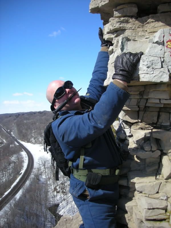
14:19 We arrive at the base of the waterfall and climb up

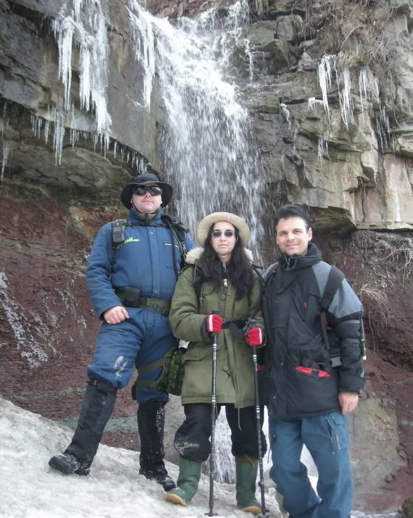
14:29 At the top of the waterfall we saw a lot of flow this time of year. Yesterday was the spring Equinox, a glorious celebratory day as spring is now upon us!

14:35 With the cool spring air upon us, we took some photos and headed down. Brian had asked us to bring him here as he has not been to this spot. Our friends Chris and Sly took us here last summer barefoot.

15:10 We arrived at the base of the falls to head out.

15:30 We sat for a rest just under the Queenston Lewiston bridge and tried to get a compass bearing. My Brunton electronic compass was broken. Brians Swiss Army knife compass also was malfunctioning. We guessed our direction by the fact the gorge ran North to South.

15:46 We decided to head Northward and head towards the truck.

16:00 We passed the sludge farm and several other dogs en-route back towards the truck.

16:32 We arrived back at the truck from our short hike, stripped off our gear and headed home

Sunday, 16 March 2008

Spencer Gorge Hike 200803-16

Sunday, March 16 - 2008
10:15 – 15:30
Start: 10:15
Roads: Wet from snow, Ice Patches
Visibility: 24km
Temp: +1C
Area: Spencer Gorge
Vehicle: Toyota Matrix
Weather: Bright & Sunny, no wind
Trail Conditions: Packed Snow and ice
Hikers: Tori, Wolf, Brian, Chuck
Plan: Hike to the base of the large waterfall
GPS: 43.2794 x -79.9789

10:00 We arrived at the parking lot after a very unusual ride up with Brian at the helm.

10:04 Chucks hydration bladder leaked all over my blue coveralls and soaked them. Thankfully my thermal underwear is somewhat waterproof. They felt very cold to put on, but hopefully along the trail my body heat will warm them up and I won’t notice it.

10:15 We hit the trails to find the steel lookout to see the big waterfall and sheer canyon walls. Tori and I have been here many years ago and thought it would be best to come back and rappel into the gorge. Sadly, neither Brian nor Chuck have their top-rope certification for rappelling like Tori and I do.

10:20 We headed up along the ice and snow packed trails, thankfully we canceled the snow-shoe rental yesterday as they would have been useless today and really gotten in the way.

10:40 We found a bridge with a stream running under it, and made our way to the edge of the escarpment where the stream turned into a very tiny waterfall. We looked over the edge to see a 2m drop which would have been difficult to navigate, but a little too dangerous for all of us.

11:12 We found that the big waterfall runs off and leads out to an old train bridge in Dundas, just beside Dundas District Public School which is noted as the most haunted school in Ontario, Canada. Beside the school is an old train tunnel which Tori and I have done some rappelling before and I have done some nude photograph shoots in some of the ruins there. We figured that in summer, the old train tunnel may be a better entrance point than rappelling.

11:16 We found some great out-croppings to rest, journal and photograph.

11:40 We found an area which looked like we could descent the steep canyon walls to the valley below.

11:48 We started our descent and snaked our way though the treacherous, steep, rocky walls lined with trees and loose shale. Thankfully we had our hiking poles to help the descent. They were very helpful in stopping us from toppling over most of the time.

12:50 Brian walked down some slippy areas and twisted his knee a bit.

13:12 We stopped at the base of the huge hill and rested. Tori and Brian took some pain killers and we all had a few energy bars.

13:18 Some large trains passed by while we were relaxing and we took some photographs of them. We headed out on the trails to find a new route home as we would not be able to visit the large waterfall on this trip. Oddly this will be one of the first hikes we’ve done and not accomplished our goals. Perhaps we will be able to in another visit. We headed out along the train tracks until we came across a trail heading to the north, which would start to take us back to the parking lot. We asked a passing hiker who said that it takes us towards the small waterfall, then back to the parking lot. We did not realise there was two waterfalls!

13:30 We started the journey Northward to find out we were on the Bruce Trail again – at least we knew the lady hiker had given us proper directions as we were starting to wonder about where we were headed.

14:03 After a long hike along the stream towards the waterfall, to our surprise a waterfall came into view!

14:20 We stood at the base of Websters falls and got some photographs. This was the first time Brian had ever been close to a waterfall. We took some photographs of all of us infront of the falls then started to heard up the long, black steel staircase which had white blazes on it as well.

14:40 We climbed back up the large steel stops and saw lots of people. We had to stop and rest for a while, I also took the time to write in my hike journal.

15:08 We arrived back at the car, somewhat exhausted as it was a long hike back, and frustrated because we still couldn’t get to the large waterfall we wanted to see. We found Brian had a $5.00 ticket on his windscreen, but he had some cash and we paid the ticket and put it in the nearby box. We stripped off our clothes. Wolf was wearing his Faded Glory boots, gaiters, blue jumpsuit, facemask, and for the first time ESS v12 goggles. Tori wore her rubber boots, nylon pants, and parka. This was the first real hike with the V12 goggles. They performed very well as they did not fog or get damp water on the inside at all. It was a great hike.

15:25 Wolf took the helm and we headed for home.

Sunday, 9 March 2008

Short Hike at Short Hills 200803-09

Sunday, March 09 - 2008
11:00 – 14:15
Start: 11:10
Roads: snow covered
Visibility: 24km
Temp: -3C
Area: Rockway Falls
Vehicle: Black Sunfire
Weather: Bright & Sunny, no wind
Trail Conditions: Deep Snow Covered with ice
Hikers: Tori, Wolf, Chuck, Merlin, Morgana
Plan: Hike the blue Number 4 trail.
GPS: 49.1053 x -79.2809

We were supposed to get together with a friend we met on facebook called Sadie, but sadly the Niva only seats 4 and we didnt have enough room for them :-( Hopefully next week, if the weather is better we can take 2 cars and Sadie and her partner can join us.

11:00 We arrived to find the main driveway all covered in snow, and had to park on the street with a couple of other vehicles. The park had few tracks leading to the trailhead.

11:10 We hit the trails to find only one set of tracks which were put in the middle of an old snow mobile track, although snowmobiles are not supposed to be allowed in this park.

11:20 after seemingly forever trodding through the deep snow, we came to a concrete bridge and looked over, the water only partially frozen.

11:45 It took forever to get to the trail head. The snow slowed us down very badly. We decided to head on the blue Number 4 trail up a steep hill to the west. We decided to head up the steep hill to the west. We had to stop several times to rest as the knee-deep snow made it difficult to hike through.

12:09 We reached the top of the hill after a couple of breaks and continued on.

12:15 The area was so beautiful we had to stop and take in this untouched area as there were no human tracks anywhere. The sky was clear and blue. We took a few photos.

12:40 We found the bench the crest of a hill on the trail. This denoted 1/3 of the trail completed. Tori was feeling tired and sore as well as Brian. We sat on the bench for a bit then decided as this was Brian's 1st winter hike EVER, that we should head back to the Niva.

13:00 We stopped to admire the beauty of this place, Tori's ankle was bothering her, Brians knee was bothering him and my hip was starting to trouble me. It could have been from having to walk in odd positions through the snow, and our bodies trying to compensate. The snow was almost hip deep in some places.

13:34 We arrived at the top of a big hill just before the trailhead and joked that if we rolled down it, we'd bend our hiking poles, stand up and they'd be S-shaped! We laughed and laughed, sadly Chuck did not have any hiking poles to potentially bend.

13:45 I rolled partially down a hill and so did Tori – much to Brian and Chuck's delight and amusement. Then we headed back towards the car after brushing ourselves off.

13:56 Tori met up with a rambunctious black dog who barked at her when she met up with him. There was also a man holding a beige colored terrier as well. Chuck commented that if our little ones had been with us it would have been a big four-way brawl!

14:00 Brian and Tori had some difficulties making it up the steep, snow covered, unforgiving hill that led back to the Niva. We had to stop and rest for a few mins.

14:15 Tired, and exhausted we arrived back at the Niva, stripped off our gear and headed for home. Sadly this hike was unfulfilling as it was very short and we couldn't bring Sadie C and her partner with us.

Sunday, 2 March 2008

Rockway Falls Hike - 200803-02

Rockway Falls Hike - 200803-02
Current mood: enthralled
Category: Travel and Places
Sunday, March 02 - 2008
13:00 – 17:15
Start: 13:08
Roads: Wet from melting snow
Visibility: 24km
Temp: +4C
Area: Rockway Falls
Vehicle: Black Sunfire
Weather: Bright & Sunny, no wind
Trail Conditions: Deep Snow Covered with ice
Hikers: Tori, Wolf, Chuck, Merlin, Morgana
Plan: Hike to the Rockway Falls
GPS: 43.1111 -79.3228

13:00 We arrived at the community center near the top of Rockway falls & kitted up. Wolf wore Faded Glory boots, gaiters, blue jumpsuit, ski-mask, ESS goggles & camelbak hydration pack. Tori wore her rubber boots which she discovered had some splits in them, nylon pants, khaki sweater, parka and black camelbak backpack.

13:08 We hit the trails and started to make our way but wanted to have a quick look at the top of the falls from the road. Tori stayed back and Chuck & Wolf went to have a look.

13:10 We started along the trails to find they were not well traveled but had seen a little use lately.

13:15 We came across a small sign attached to a tree near a picturesque lookout which was dedicated to Ryan Patrick McGrath who died May 02 – 2005 and had an Irish poem on it which started "May the road rise to meet you".

13:18 We continued on to a nice outcroppong and grabbed a few more photos.

13:26 We came across a few giant boulders which led to a bit of a drop-off which we all carefully navigated as the calf-deep snow had a layer of ice underneath. We kept going until we saw an area that looked suitable for a relatively safe descent.

13:50 We began our descent to find out very quickly that the snow covered area had a layer of ice underneath and would be best done on our buttocks. Chuck got quite a bit of speed on, and I followed soon after. We caught the descent on video.

14:08 We got to the bottom of our first large ass-descent to find ourselves confronted with more descent to the bottom of the canyon.

14:14 I descended down the steep embankment at a slow pace only to be stopped by a tree which was on the edge of a 1m drop. I slowly navigated down the drop & helped Morgana down it. Chuck took a more treacherous route which led to more sliding on his part.

14:20 I caught his slide and Tori's slide on video as she took the same route as Chuck, followed by Merlin at her side.

14:22 We started along the canyon floor to come across some fantastic and beautiful rock formation and frozen streams which still had water flowing under it. There were a few areas which still had water exposed. Some of the waterflows made very nice eddy's under the clear, thin ice.

15:01 We ended up splitting up as Chuck started climbing up the canyon walls and Tori and I headed closer towards the falls over the large, ice covered boulders.

15:20 We reached the waterfall and we were a little leery about going over the frozen, snow covered water in the event the water carved a big hollow under the ice and it collapsed as we could fall through.

15:25 As we started to ascend the rockface, we saw a cave not too far from Chuck. We decided to ascent to it and have a closer look.

15:40 We arrived at the top of the canyon, near the cave to take some photos as a natural spring poured out of it. Sadly it was too small to enter very deeply. We took some photos and decided to find a way straight-up over the steep rocks.

15:55 We came to a spot where chuck had found while he was waiting for us, that he we could get up the top section of the rocks. We were at a crest in the gorge, but still had about 2m of large, sheer rocks above us. As Tori was lighter we sent her up first to find that t was too difficult even for her. Chuck and I surely could not attempt it. We decided to move on and see what lie ahead.

16:10 We arrived at a very dangerous looking area at the top of the canyon. Under a rocky outcropping, below the very top of the gorge, the area had been dripped on for quite some time and was a solid sheet of ice. Covered in s now. Chuck suggested throwing some rocks on the ice for traction but it did nothing. Since I was in the lead, I started to cross the 60cm wide tract of ice about 3m long on all fours. On one side a steep drop-off about 30M with sharp wood and construction supplies which had been dumped there, on the other side – more ice. About ½ way across the ice patch I started to slip. With no hand holds, very nervous, and with Merlin whining non-stop, I decided without an ice-ax and crampons it would be best if I turn back. Slowly, on all fours – I backed my way out of the area almost slipping to my doom on more than one occasion.

16:28 We arrived back at the top of the waterfall, descended to the frozen run-off and made our way back to the area where we came down originally. We went to take some photos of Chuck infont of the waterfall, and he fell through some of the ice up to his waist, we laughed and took some photos, then helped rescue him from being stuck.

16:31 We passed some young people dressed in running shoes & jogging suit shirts on the trails.

16:40 We arrived at our ascent point to fond another couple descending, also mostly on their buttocks.

16:45 After completing our ascent we arrived at the top of the gorge & Chuck wanted some videos of his descent so he did it again and we caught it on film.

17:00 We started our way back to the car when Morgana made a wrong move and fell between some rocks. Chuck and Wolf went on up ahead and Tori rescued her.

17:10 We watched the young people in the gorge to make sure they were okay as this can be a dangerous place in the winter.

17:10 We arrived back at the car, and stripped off our gear to head for home.